


Long Trail End-to-End Summary
Long Trail End-to-End Summary
~Completed in two sections~
June 24 – July 4, 1992: Massachusetts to Brandon Gap
June 19 – July 1, 1993: Brandon Gap to Canada
Submitted to the Green Mountain Club by
Scott Kendall
Nov 15, 2002
Ten years have passed since we made it to the Canadian border swath, a long time compared to the mere 24 days it took to hike from Massachusetts to Canada on the Long Trail during the summers of 1992 and 1993. But although this adventure was ten years ago, we continue to reminisce, flip through the photos, and bring up obscure details of our Long Trail experience in occasional conversations.
Hiking the Long Trail end-to-end, a somewhat repetitive matter of putting one foot in front of the other 1,478,400 times, has somehow deeply affected our lives. In many ways, it was more than a hike, more than simply walking a “footpath in the wilderness” for a few weeks. We were young, inexperienced, and thirsting for a worthy outlet for our energies, and the Long Trail -- sitting right in our backyard -- posed a direct and obvious challenge, with reaching Canada the goal. In the end, we met the goal, but what really keeps us talking and keeps the Long Trail fresh in our minds is the pristine scenery we saw, the colorful fellow hikers we met, and, above all, the unscriptable and often calamitous episodes that happened on our way. With a few untested notions of what was in store, we set off on the trail one rainy Wednesday in the June of 1992…
Section I
June 24 – July 4, 1992: Massachusetts to Brandon Gap
125.5 miles
Day 1: June 24, 1992
Begin: Williamstown, MA
End: Primitive Tenting Area
Day’s Distance:14.8 miles
Distance-to-date:14.8 miles
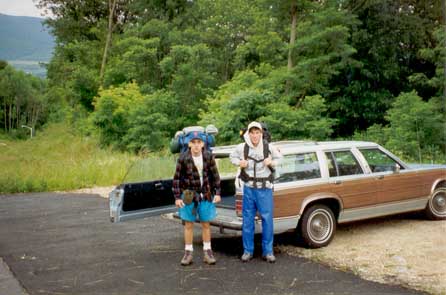
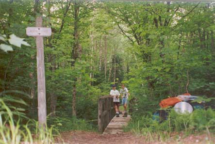
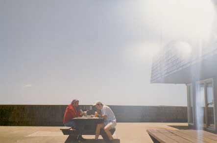
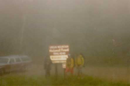
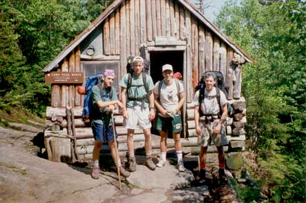
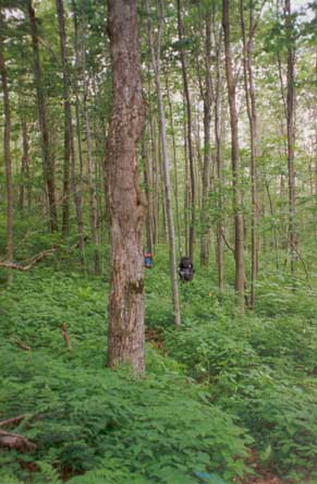
The big drop-off. Charlie Cummings (trailname “Stub”) and I (trailname “The Weasel”) wish his mom farewell before bravely heading into the soaked woods. The first hiker we meet is near the Vermont border. He tells us that he's hiked most of the AT and the most dangerous section is in Pennsylvania. In that section he carried a gun and always camped a safe distance away from the trail. We bid him a quick goodbye.
Stop at Seth Warner Shelter for lunch. Two complete rednecks in full army camo with standard issue sleeping bags are hanging around lighting off firecrackers. They keep asking us, “Where’s the nearest Western Union?” I wolf down an apple and we head out of there.
Reach Congdon Camp at dusk.The cabin is crammed to capacity with Boy Scouts. Unfortunately, they do not offer to make room so we are forced to press on to the Primitive Tenting Area.We set up a tent and get a few minutes of sleep during a raging thunderstorm that night.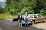
The Drop Off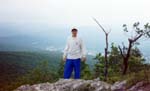
Summit of Pine Cobble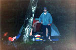
Soggy camp
Day 2: June 25, 1992
Begin: Primitive Tenting Area
End: Goddard Shelter
Day’s Distance: 13.2 miles
Distance-to-date: 28.0 miles
Route 9! This ascent, coupled with the continued rain, deflates our spirits for the duration of the day. Is the rest of the trail going to be this brutal? My God. The push up Glastenbury Mountain, with our extremely heavy and inefficiently packed backpacks, nearly breaks us. After an extended period of low blood sugar “hiker’s low”, we reach Goddard Shelter in near darkness and promptly pass out in our soaked sleeping bags. Looking back, the ascent from Route 9 was probably the hardest section of the trail.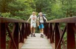
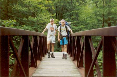
Bridge near Rte. 9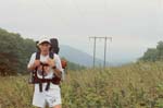
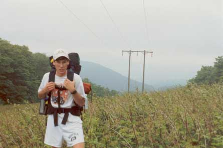
Scott on Maple Hill
Day 3: June 26, 1992
Begin: Goddard Shelter
End: Deerfield River
Day’s Distance: 12.5 miles
Distance-to-date: 40.5 miles
We wake up late to the first sun of the trip and cook up an elaborate pancake and bacon breakfast. Chalk this one up to inexperience -- the bacon causes a wild grease fire on our skillet and is wholly inedible after we dump a full water bottle on it to put out the fire. The views from the Glastenbury Mountain firetower are panoramically green. The rest of the day passes relatively uneventfully, with the exception of lunch. Somehow, although it's only our third day hiking, we run out of food. I kid you not -- Charlie and I suck down tubes of maple syrup and jelly for lunch. A backpacking nadir for sure.
On the banks of Westwardsboro Road (the Kellystand as we call it in Arlington), we successfully retrieve a food resupply package my parents dropped off earlier in the day. With this our lives improve considerably -- no more maple syrup tubes.
Goddard Shelter
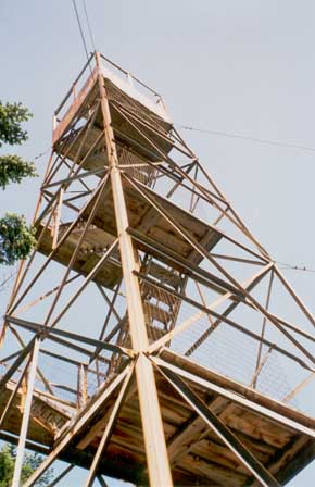
Glastenbury Mtn. fire tower
Looking down from the Glastenbury Mtn. fire tower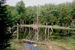
Beaver pond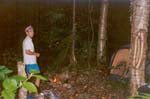
Camping near the E. branch of the Deerfield River
Day 4: June 27, 1992
Begin: Deerfield River
End: Spruce Peak Shelter
Day’s Distance: 13.6 miles
Distance-to-date: 54.1 miles
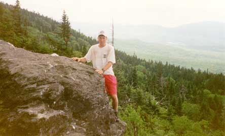
The ascent up the back of Stratton Mountain goes quickly, and before long we're perched at the top of the Stratton Mountain firetower. A slight misstep on the way down and I almost careen headfirst down the stairs. We check ourselves into Spruce Peak Shelter by dusk and rehydrate liberally at the gushing mountain spring.
Charlie pre Stratton Mtn ascent
Stratton Mtn. fire tower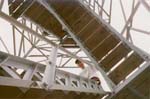
Carefully descending

Winhall Rivx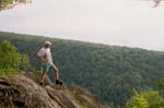
Scott prospects from Prospect Rock
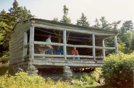
Spruce Peak Shelter
Day 5: June 28, 1992
Begin: Spruce Peak Shelter
End: Mad Tom Shelter
Day’s Distance: 6.3 miles
Distance-to-date: 60.4 miles
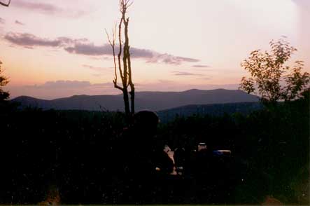
The morning stillness is broken by a chaotic cluster of cries coming from all directions -- an ambush! My family, spearheaded by my little cousins, emerges from behind trees on both sides of the trail. They had hiked up from Rt. 30 a couple of miles with the sole intention of scaring us out of our hiking boots. After a relaxing hike back to Rt. 30 and a quick lunch, we part ways and once again it is Charlie and Scott vs. the State of Vermont. We take it easy the rest of the day, check out the views from Bromley Mountain, and make it to Mad Tom Shelter in time for a great sunset.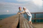
Bromley Mtn. observation tower
Bromley Mtn. observation tower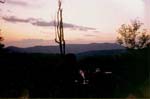
Sunset at Mad Tom Shelter
Day 6: June 29, 1992
Begin: Mad Tom Shelter
End: Big Branch Shelter
Day’s Distance: 12.4 miles
Distance-to-date: 72.8 miles
As usual, we get a late start and make it to Little Rock Pond by noon-ish. Nothing very eventful happens this day; upon arrival at the Big Branch Shelter, we go for a much needed swim in the cool pools and rushing water of the Big Branch. Very refreshing.
Day 7: June 30, 1992
Begin: Big Branch Shelter
End: Minerva Hinchey Shelter
Day’s Distance: 13.0 miles
Distance-to-date: 85.8 miles
We pick up our second resupply near Rt. 140 -- Charlie’s mom had left an enormous batch of homemade chocolate chip cookies. We devour them all and nauseously proceed to the Minerva Hinchey Shelter. A recent entry in the shelter log by the Ruby Crested Bird Nerd says, “I left a cold one down in the stream for whoever happens by. Enjoy!” We rush down to the stream, and sure enough -- an ice cold can of Budweiser! Thank you Ruby Crested Bird Nerd -- we never caught up to him to say thank you. Between the buzzing mosquitoes, scrambling porcupines, and hollering moose, we squeeze in a bad night’s rest.
Day 8: July 1, 1992
Begin: Minerva Hinchey Shelter
End: Cooper Lodge
Day’s Distance: 13.6 miles
Distance-to-date: 99.4 miles
Highlight of the day is definitely a dip in the Clarendon Gorge -- a natural Jacuzzi. The rest of the day is a slog as we both feel on the verge of getting sick. Nonetheless, upon reaching Governor Clement Shelter, we decide to push on to Cooper Lodge nestled near the summit of Killington Peak. A light rain, chilly conditions, and faltering energy levels challenge us as we ascend the second highest mountain in Vermont. In the last half hour of light, we reach the empty Cooper Lodge. It's freezing, we're exhausted. A quick bowl of ramen noodles and we pass out immediately after inflating our Thermarests.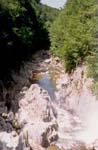
Clarendon Gorge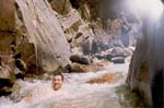
Natural jacuzzi
Day 9: July 2, 1992
Begin: Cooper Lodge
End: Rolston Rest Shelter
Day’s Distance: 10.8 miles
Distance-to-date: 110.2 miles
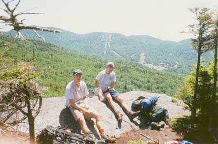
After a rock-solid ten-hour sleep, we wake up to a brilliant day. Venturing to the summit of Killington, we make an amazing discovery -- the Killington ski area cafeteria is open! We devour some snacks and then hit the trail fully energized with all hints of sickness gone. It's a great Vermont day and the views and scenery are worth all the grimness of the previous days. We grab some stove fuel we'd sent ahead to the Inn at Long Trail and continue on to the Rolston Rest Shelter.
Cooper Lodge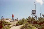
Killington summit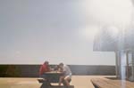
Lunch at the Killington cafeteria
View of Pico from Killington
View of Killington from Pico
Scott rests on a Pico chairlift
Day 10: July 3, 1992
Begin: Rolston Rest Shelter
End: Sunrise Shelter
Day’s Distance: 14.4 miles
Distance-to-date: 124.6 miles
Division VI – worst division ever. We decide to cover as much ground as possible to escape the tendrils of the stubborn Chittenden Reservoir that refuses to leave our view. We confirm an earlier shelter’s register entry that David Logan shelter has been “porcupinized” and head on to the Sunrise Shelter.
Day 11: July 4, 1992
Begin: Sunrise Shelter
End: Brandon Gap
Day’s Distance: 0.9 miles
Distance-to-date: 125.5 miles
Not really much of a hiking day, we make it to Brandon Gap in less than half an hour. My mom picks us up shortly afterward. I force Charlie to keep his window open for ventilation purposes.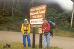
Brandon Gap finish
Section II
June 19 – July 1, 1993: Brandon Gap to Canada
154.4 miles
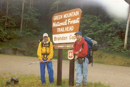
Day 12: June 19, 1993
Begin: Brandon Gap
End: Boyce Shelter
Day’s Distance: 13.0 miles
Distance-to-date: 138.5 miles
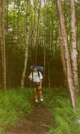
A year later and Charlie and I are charged for Part Two. We feel a lot more prepared this time around. No messing with maple syrup, bacon, extra socks, a tent -- this time we travel with the bare essentials. At the same time, we cut down the number of resupplies to just one for the entire northern half of the trail, so our packs are in fact heavier than before.
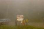
The most significant change is bringing Alex Jermyn (trailname “The Midget”) into the fold. He is new to the Long Trail and eager to learn its ways. With the now traditional farewell to Charlie’s mom, the three of us depart from a rainy Brandon Gap and head once again into the dark, soaked forest.
The rain lets up for part of the afternoon but soon starts coming down harder than ever. We duck into Boyce Shelter and manage a wet night of sleep.
Part 2: Rainy start at Brandon Gap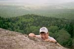
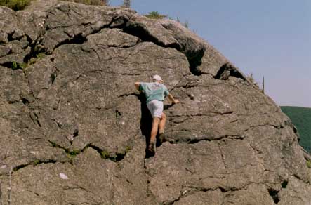
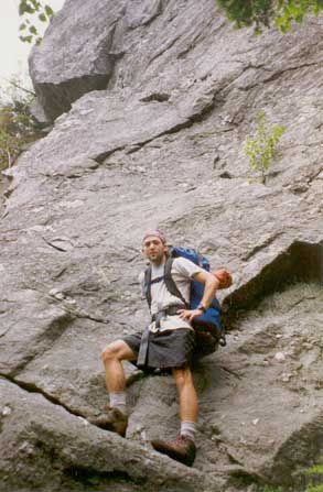
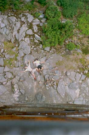
Scott falling off a cliff
Well, not really

Taking a break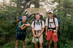
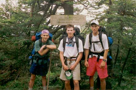
Mid-point of the Long Trail
Day 13: June 20, 1993
Begin: Boyce Shelter
End: Cooley Glen Shelter
Day’s Distance: 9.5 miles
Distance-to-date: 148.0 miles
Nothing really to say for this day other than it pours. Continuously. No sites, no photos, no memories. Sheer mileage.
Day 14: June 21, 1993
Begin: Cooley Glen Shelter
End: Glen Ellen Lodge
Day’s Distance: 12.9 miles
Distance-to-date: 160.9 miles
Another extremely well hydrated day. We march through muddy puddles all the way to Lincoln Gap and then climb to the treeless summit of Mount Abraham, where the fog is so thick we almost lose the trail. We all agree, the .2 mile spur down to the Glen Ellen Lodge is the longest .2 miles we’ve ever hiked. Huge ramen meal to stave off sickness.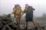
Foggy summit of Mt. Abraham
Day 15: June 22, 1993
Begin: Glen Ellen Lodge
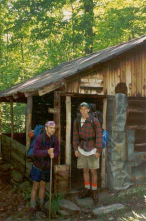
End: Birch Glen Camp
Day’s Distance: 6.0 miles
Distance-to-date: 166.9 miles
Worst day of the Long Trail. Torrential downpour, lightning everywhere. All three of us start getting colds. Canada seems to be getting farther and farther away. Will we ever make it? We turn in early at Birch Glen Camp and try to recover. As I fade into sleep, I can’t help but wonder if all these “Glens” are somehow responsible for the rain.
Day 16: June 23, 1993
Begin: Birch Glen Camp
End: Gorham Lodge
Day’s Distance: 10.6 miles
Distance-to-date: 177.5 miles
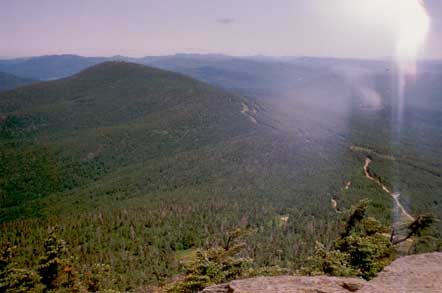
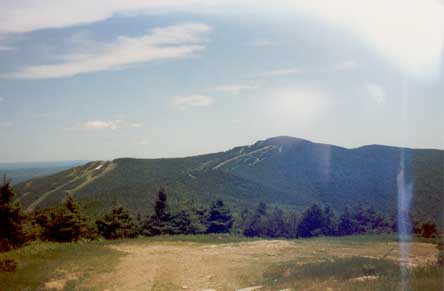
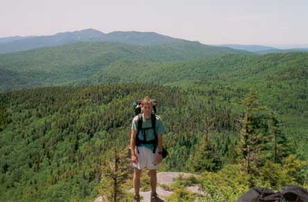
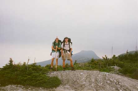
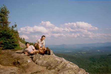
First sun in three days! All illnesses evaporate and we hit the trail with a new-found vigor. Perhaps the most scenic day of the entire hike. The rough evergreen forest and rocky ridgeline culminates in unprecedented views from Camel’s Hump. Our spirits soar as we take in the 360 degree view and brace ourselves against the strong winds.
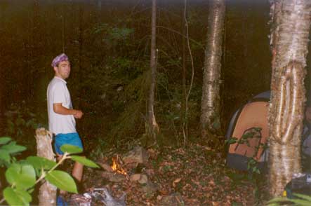
In Gorham Lodge, we meet up with our friend Gad Nestel who is hiking southbound for a few days. The highlight of the night is when Gad starts a gas fire with his stove and almost burns Gorham Lodge down. We still talk about this to this day.
Setting off from Birch Glen Camp
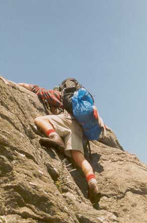
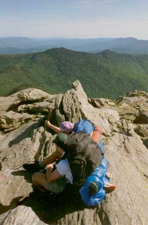
Alex in an extreme backpacking manuever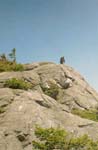
Ridgeline on way to Camel's Hump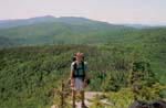
Ridgeline on way to Camel's Hump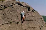
Extreme manuever by Scott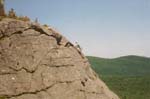
Bad place to fall
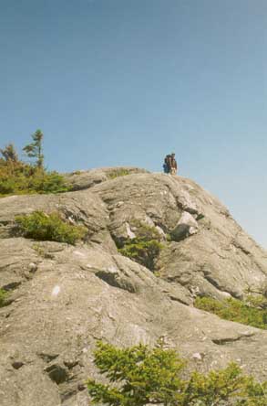
Summit of Camel's Hump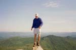
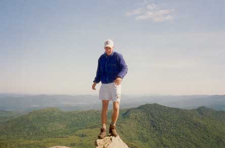
Scott on Camel's Hump
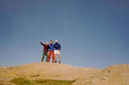
Charlie & Alex on Camel's Hump
Group shot on Camel's Hump
Day 17: June 24, 1993
Begin: Gorham Lodge
End: Duck Brook Shelter
Day’s Distance: 9.2 miles
Distance-to-date: 186.7 miles
After gathering our resupply in Jonesville, we head back into the hills to the Duck Brook Shelter. Despite the name, we find zero ducks. A highlight occurs when I slip on some rocks in the river but recover before falling down a steep cliff. I celebrate surviving this brush with death by treating myself to a huge bowl of ramen.
Setting off from Gorham Lodge (L to R): Charlie, Scott, Gad, Alex
Day 18: June 25, 1993
Begin: Duck Brook Shelter
End: Taylor Lodge
Day’s Distance: 13.2 miles
Distance-to-date: 199.9 miles
The ascent up Bolton Mountain through forests of dead trees is buggy and arduous. We pause for a brief lunch near the summit before the bugs overpower us and force us to hit the trail. A long “slab” of an eastern slope, and we reach Taylor Lodge. After an unsuccessful and ridiculously extreme attempt to find the water source, we give up and dream for 8 hours about potable water and the next day's ascent of Mt. Mansfield.
Braving the bugs at the top of Bolton Mtn.
Day 19: June 26, 1993
Begin: Taylor Lodge
End: Taft Lodge
Day’s Distance: 9.2 miles
Distance-to-date: 209.1 miles
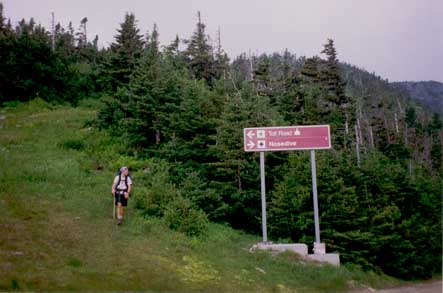
We motor up to the Forehead of Mt. Mansfield in the face of unpredictable weather. At a pit stop in the Octagon Pie-In-the-Sky restaurant, we figure out what it will take us to reach Canada. Charlie has to start work on July 2, so that only gives us 5 hiking days after today. We calculate if we want to make it to Canada, we'll have to average over 14 miles a day for the next 5 days. The trail has beaten us down considerably but the desire to reach Canada is strong. We decide to go for it and gun it under incoming thunderclouds over the Chin of Mt. Mansfield, the highest point in Vermont.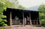
Taylor Lodge, at the foot of Mt. Mansfield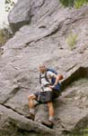
Charlie poses on the Forehead
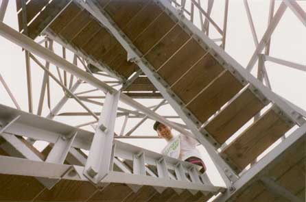
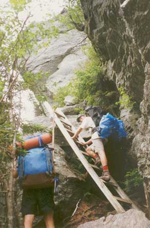
Climbing the ladders on the Forehead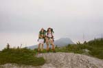
Scott & Alex on the Nose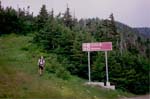
Charlie hikes toward Octogon Restaurant on a ski trail
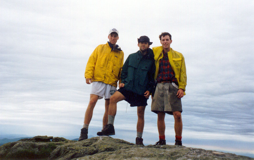
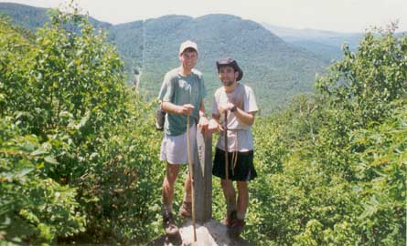
The classic Long Trail photo: Scott, Charlie, and Alex on the Chin of Mt. Mansfield, the highest point in Vermont (click for big version)
Day 20: June 27, 1993
Begin: Taft Lodge
End: Bear Hollow
Day’s Distance: 12.1 miles
Distance-to-date: 221.2 miles
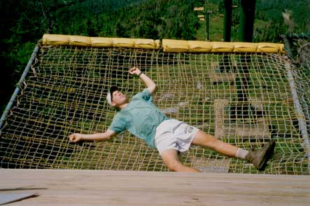
After a great night’s sleep in rustic Taft Lodge, we push on to Bear Hollow. A short rest in a ski lift net at Madonna Peak charges me up for a long slog through encroaching forests of stinging nettles on the way to the Bear Hollow shelter.
Stinging nettles near Bear Hollow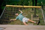
Scott tired at Smugs
Day 21: June 28, 1993
Begin: Bear Hollow
End: Corliss Camp
Day’s Distance: 14.9 miles
Distance-to-date: 236.1 miles
We walk along Rt. 15 into Johnson, VT and have a great pancake breakfast at a local restaurant. No one wants to pick up three dirty backpackers, so we walk all the way back to the trail. The day is a long one, and we reach Corliss Camp in darkness. We don’t waste time getting right to sleep –- we have some long days ahead. Canada for the first time feels attainable.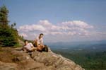
Taking a break to enjoy a view
Day 22: June 29, 1993
Begin: Corliss Camp
End: Tillotson Camp
Day’s Distance: 15.0 miles
Distance-to-date: 251.1 miles
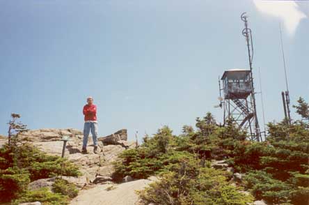
The views from the Mt. Belvidere fire tower and dread of Devil’s Gulch are the two significant features of this day. After hanging on every word of the Guide Book of the Long Trail for 22 days, we've grown accustomed to its conservative tone. But the harsh description of Devil’s Gulch, “a ferny defile,” has us quaking in our boots. As it turns out, we're through Devil’s Gulch almost before we identify it –- and Tillotson Camp is mentally only a short distance beyond. After chipping off 15 miles, we go to sleep knowing that Canada is just two long days away.
On the Belvidere Mtn. fire tower
Splat
Day 23: June 30, 1993
Begin: Tillotson Camp
End: Jay Camp
Day’s Distance: 11.8 miles
Distance-to-date: 262.9 miles
This day is a blur in my memory. The miles fly out of my boots. The idea of hitting McDonald’s after reaching Canada materializes. In fact, the idea of time “after reaching Canada” materializes. We are that close.
Day 24: July 1, 1993
Begin: Jay Camp
End: Canada !
Day’s Distance: 17.0 miles
Distance-to-date: 279.9 miles
The last push, and our most ambitious mileage attempt to date. We decide to travel light and ditch our packs at Jay Pass with the plan of retrieving them once we're picked up in North Troy by my mom. We're down to half a bagel each. Other than that, we have a camera and water. We enjoy the last few miles half-walking/ half-running. Without packs, it feels like we're walking on the moon. The border swath appears before too long, and soon enough we are all in my mom’s car headed to McDonald’s.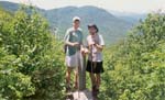
Brand new End-to-enders Scott & Charlie at the border swath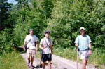
Last steps
At the very endThis trip to McDonald’s has assumed a legendary status. After days of anticipation, we lacked the usual eating restraints. I consumed all 4 extra value meals (Big Mac, 2 Cheeseburgers, McChicken, Filet-o-Fish, all with fries) plus 2 Fried Apple pies and a hot fudge sundae, a total intake of 5,060 calories. I felt fine. Charlie, however, ate himself to the point of nausea and hung his head out of the car for the entire ride back to southern Vermont.
In the end, though, he kept everything down, and so our journey through the length of the Green Mountains was deemed a success by all.
Additional info:
Green Mountain Club
"Protecting and Maintaining Vermont's Long Trail Since 1910"