


Mountain Biking - Bay Area - Peninsula
- Big Basin Redwoods State Park
- El Corte de Madera OSP (from Skegg's Point)

- Montara Mtn. ("The Wall" ride)
- Purisima OSP (Whittenmore Gulch)
- Saratoga Gap Loop
- Skyline Ridge Loop (Monte Bello, Skyline Ridge, Russian Ridge, Coal Creek OSPs)
- Soquel Demonstration Forest
- Water Dog Park
- Wilder Ranch
- US 101S
- CA 85S toward Cupertino
- De Anza Boulevard exit
- R onto S De Anza Blvd.
- Continue on Saratoga Sunnyvale Rd. up and over mountains
- R onto Big Basin Way (CA 9)
- Follow to Park Headquarters (note $5 parking fee)
- 280 S
- Hwy 1 exit
- S on Hwy 1 approx. 7 mi after freeway ends
- Park in either Gray Whale Cove parking lot on left or Montara State Beach/McNee Ranch parking lot 1 mi south
- Resolution - start at the Fir Trail to ride perhaps the best downhill in the park
- North Leaf - slabs a slope for most of the way
- Methuselah - meandering downhill curves through dense redwood groves bottoming out at a tortured stream crossing
- Giant Salamander - rolling singletrack with short steep stretches near the Timberview Trail
- Manzanita - great ride both ways with views of the ocean, quite rocky in sections
- Crosscut - Short level trail that finishes off with a bang into the Gordon Mill Trail
- El Corte de Madera Creek - gentle singletrack through pristine stretches of forest that provides an easy way to climb out
- Steam Donkey - final section is a straight shot bomb down to the Spring Board Trail; just jump the board, it's easy
- Sierra Morena - a pretty non-descript side-slabbing trail providing a much better option than Skyline
- Blue Blossom Trail - be sure to run this from the Bear Gulch Road side down as some pitches are too steep to bike up
- South Leaf - have never biked this!
Another popular option is to create a big loop ride from Purisima OSP - see details on this under the Purisima listing.
Recommended loop (8.8 mi):
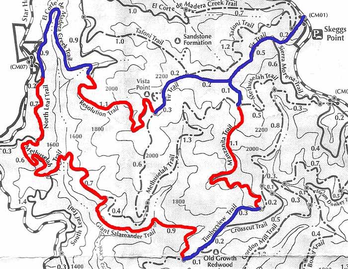
Red denotes singletrack, blue fire road
This loop hits several of the best singletracks in the park; many more loops can be created to hit some of the other trails mentioned above.- From Skegg's Point, bike north on Skyline Blvd to gate on left
- Enter gate and take a sharp L onto a paved road
- After a 0.2 mile climb, paved road ends at the beginning of the Fir Trail, a wide fireroad
- Follow the mostly downhill Fir Trail 1.0 mi to a junction with Resolution Trail
- R onto Resolution Trail, here begins the singletrack
- Descend Resolution trail for 1.1 miles until a junction with El Corte de Madera Creek Trail
- L downhill onto El Corte de Madera Creek Trail, follow 0.9 miles down and then up a short climb to the junction of the North Leaf Trail
- L on the North Leaf Trail and follow the mostly level trail for 0.7 miles to the junction with the Methuselah Trail
- L down the Methuselah Trail and follow 0.7 miles to the junction of the Giant Salamander Trail
- R on the Giant Salamander Trail and climb most of the 0.9 miles to the junction with the Timberview Trail
- L on the Timberview trail and gradually climb 0.6 miles to the junction with the Manzanita Trail
- Sharp Left uphill on the Manzanita Trail and follow mostly uphill for 1.1 miles to a four-way junction with the Methuselah Trail
- Proceed straight through the junction for 0.1 miles to the junction with the Fir Trail
- R onto the Fir Trail and follow 0.7 miles to Skegg's Point the way you started the loop
Directions from SF: (~45 min)
- 280S, exit onto 92W
- L onto 35S at junction
- Approx 10 miles on left side (big parking lot with stone wall; note no left turn is allowed into parking lot, so turn around on one of the pulloffs up the road)
Trail Map: openspace.org PDF
Photos: Panoramas(virtualparks.org)
More info: MTB.LIVE.COM, openspace.org
 Purisima OSP (Whittenmore Gulch)
Type: Singletrack down, fireroad up
Distance: ~10 miles
Location: Near Woodside, CA [Map it]The sister park to El Corte de Madera, the terrain, scenery, and barametric pressure are very similar. After riding in both parks, there are moments when you get confused at trail intersections because you think you're in the other park. Oh well. The Whittenmore Gulch Trail is A+ singletrack, with broad ocean views from above before switchback descending into deep insular redwood groves below. After Whittenmore, you have no where to go but up. The long fireroad up is tough, but don't let it eat you for breakfast like it did my roommate - just granny it up and you'll be there soon enough.
Follow these directions to loop into El Corte de Madera singletrack:
- Going up the Purisima Creek Trail, take a right on to the Borden Hatch Mill trail
- Take a right on to the Grabtown Gulch Trail
- Follow to end, take a left onto Tunitas Creek Road
- Take first right onto Star Hill Road
- Follow down to gate CM07 (to El Corte de Madera Trail), CM08 (the "914 Trail" to North Leaf/Methuselah trails, or continue down Star Hill Road, veer left onto another paved road at first intersection, and enter through gate CM10 to access the south end of the South Leaf Trail. All of these gates lead to amazing ECDM singletrack.
- By any route, bike up to Skyline Blvd and head north for ~4 miles to the Purisima parking lot on the left
Directions from SF:
- 280S, exit onto 92W
- L onto 35S at junction
- Approx 4 miles on right, parking lot just past country store
Trail Map: openspace.org PDF
Photos: Panoramas (virtualparks.org)
More info: openspace.org
Saratoga Gap
Type: Mix of fireroads and singletrack
Distance: 13-mile loop
Location: Near Saratoga, CA [Map it]Meadows to woods to creeks to a steep, technical singletrack ascent up Table Mountain, this ride kicked my ass. Diverse terrain, settings, and vegetation make this an adventure ride. Made it through the second stream crossing; got wet on the first. Keep your map handy as some turns can be confusing - we ended up bushwacking for 10 minutes along an overgrown brook before hitting a dead end. A great ride - would be higher in the rankings if it had some technical downhill singletrack in lieu of the Grizzly Flat Trail fireroad.
Directions from SF: (~1hr)
- US 101S
- CA85S toward Cupertino
- Take Saratoga Ave Exit
- Take R onto Saratoga Ave (Route 9)
- Follow to junction with Skyline Boulevard (Route 35), parking lot at junction on left
- Singletrack trail begins in NE corner of Route 9/Skyline Blvd. intersection
Trail Map: openspace.org PDF
Photos: Panorama of Beginning of trail near Grizzly Flat TH(virtualparks.org)
More info: MTB.LIVE.COM (recommended loop is under 'For a longer ride'), openspace.org
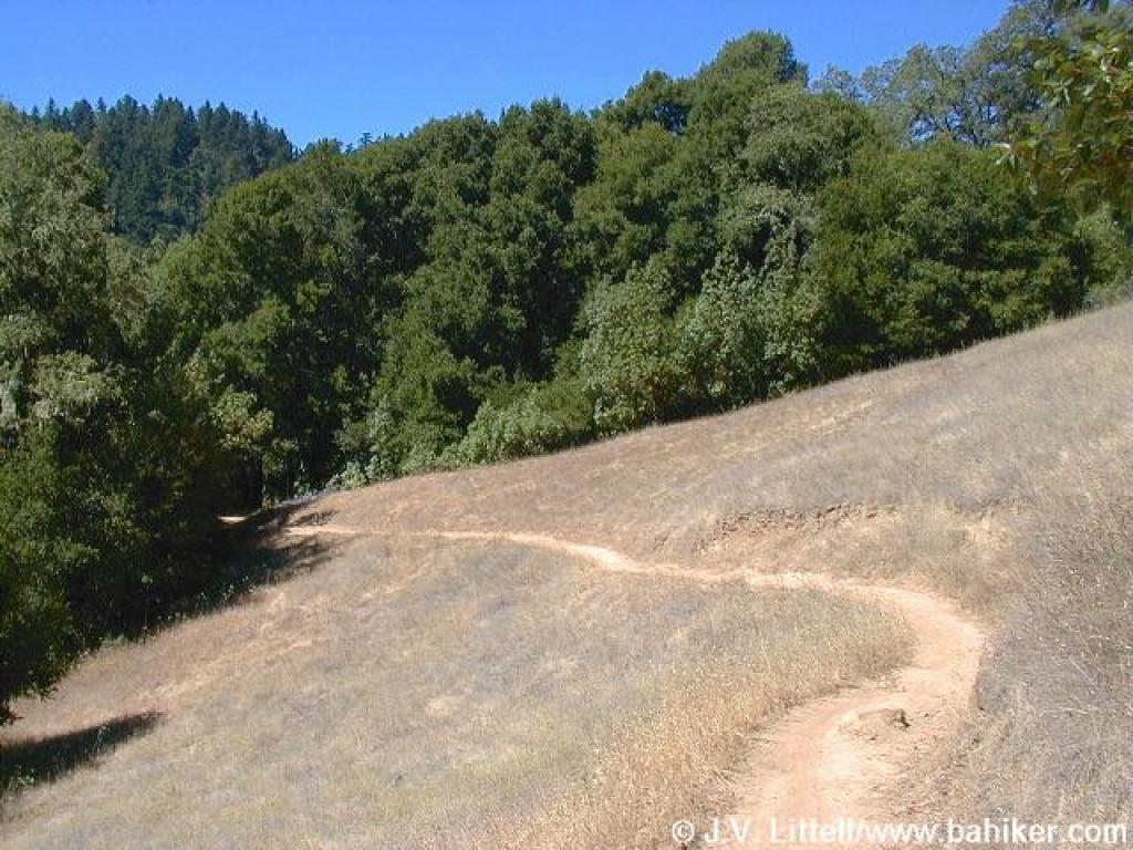
Skyline Ridge Loop
Type: Mix of fireroads and singletrack
Distance: 13-mile loop
Location: Near Los Altos, CA [Map it]This loop hits Monte Bello, Skyline ridge, Russian Ridge, and Coal Creek Open Space Preserves in a CW whirl through ridgetop meadows and oaken woods. Although there are nice sections of singletrack, they are too few and far between to make this a top 10 Bay Area ride. Some singletrack highlights of this area are the second half of the White Oak Trail, the Ancient Oaks Trail, the segment of the Ridge Trail near Mt. Melville, and the Meadow Trail. The views from the top of Borel Hill in Russian Ridge take breath. Hardest part of this ride for me was passing through the bike access gates - I timbered into a pile of thorns on one and due to a last-second swerve shouldered the next like a linebacker. Kids, be careful out there.
Recommended loop (13 mi):
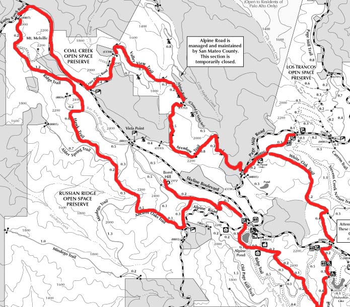
- From the Los Tranchos parking lot (see directions below), cross Page Mill Rd. and take a right onto a dusty, climbing singletrack
- Follow singletrack for 0.3 miles and take a left onto the White Oak Trail
- Follow downhill (doubletrack turning to singletrack) for 1.2 miles and take a right at first junction
- Follow 0.4 miles to Skyline Blvd. Avoid hitting bike access gate and nearby pile of thorns.
- Cross Skyline Blvd, take a right onto gravel road to Skyline Ridge parking lot
- Take a left out of the parking lot and take the left-most of the two trails for 0.2 miles to parking lot
- Stay straight and go through another bike access gate (avoid hitting shoulder)
- Follow for 0.1 miles, and take a right up steep fireroad toward Alpine Pond
- Staying to the right at every bike trail intersection, follow 1.3 to top of hill and down to Alpine Pond.
- Take a right on first trail past Alpine Pond, follow 0.1 miles and cross Alpine Road
- Pick up trail on other side of Russian Ridge Parking lot, stay to the right at all intersections and follow 0.8 miles to top of Borel Hill
- Backtrack 0.3 miles and take a right toward the Ancient Oaks Trail
- Follow 0.3 miles and take a right onto the Ancient Oaks Trail
- Follow the Ancient Oaks Trail singletrack for 0.5 miles and stay right at first trail junction
- Follow another 0.3 miles and stay left at next trail junction
- Follow another 0.4 miles and take a right onto the Hawk Trail
- Follow the Hawk Trail for 0.6 miles and take a left onto the Bay Area Ridge Trail
- Follow the singletrack Ridge Trail for 1.4 miles and take a right onto Rapley Ranch Road
- Follow Rapley Ranch Road for 0.1 miles and take a right onto Skyline Blvd.
- Follow Skyline Blvd. for 1.0 miles and take a left onto Crazy Pete's Road
- Follow Crazy Pete's Road for 0.4 miles and take a left onto the Valley View Trail
- Follow the Valley View Trail for 0.5 miles and take a left at intersection with Crazy Pete's Road
- Follow Crazy Pete's Road for 0.3 miles and take a right on Alpine Road
- Follow Alpine Road uphill for 0.2 miles and take a right at first intersection
- Follow uphill for 0.5 miles and take a left onto the Meadow Trail
- Follow Meadow Trail singletrack for 0.8 miles and take a right at first junction
- Follow for 0.5 miles to Page Mill Road
- Cross Page Mill Road and take a left onto trail
- Follow for 0.5 miles staying to the left-most trails and look for parking lot on the left
Directions from SF:
- 280S, exit onto Page Mill Road
- Follow Page Mill Road West for 9 miles
- Park in Los Trancos OSP parking lot on Right, about 1 mile east of Skyline Blvd.
Trail Maps: openspace.org PDF
Photos: White Oak Trail Singletrack (bahiker.com)
More info: openspace.org
 Soquel Demonstration Forest
Type: Mix of fireroads and singletrack
Distance: 20-mile loop
Location: North of Soquel, CA [Map it]Soquel this, Soquel that. I must've heard from half a dozen people that I had to "check out Soquel" before I finally made it out on a lazy November Sunday. After a zip up a lengthy yet easy fireroad climb you reach the edge of this vertical singletrack resort. From here, the future is intoxicating. Much like a ski area, multiple singletrack adventures lie in wait, all branching off the topsy-turvy Ridge trail (a thrill in itself). I bombed down the technical Sawpit Trail and took the chairlift (Sulphur Spring Rd) back to the top -- I couldn't leave without a test run of the Braille Trail. Jumps, drops, logs, hops -- go crazy. Personally, I left my cojones in the car. Soquel provides technical riders a suitable playground and places no limit on how far you can push yourself. Best of all, no liftlines and the ticket is paid only in sweat.
Recommended loop (~20 mi):
- From trailhead on Highland Way at junction of Hihn's Mill Rd., continue on Highland Way
- R onto Buzzard Lagoon Rd. and follow .9 mi
- Sharp R onto Aptos Creek Fire Road
- Follow mostly uphill for a total of 2.0 mi (pass through a gate after 1.1 mi and continue on)
- Enter Ridge Trail singletrack on R. Time for some fun.
- There are several ways to go at this point. Consult the trail map below to see the options. This is what I did, a great ride:
- Follow Ridge Trail 3.3 mi to end and intersection with Sawpit Trail.
- Big downhill on Sawpit Trail for 1.2 mi
- R on Hihn's Mill Road fireroad and start digging yourself out for 1.8 mi
- R onto Sulphur Springs Road. After .4 mi, take a R to stay on Sulphur Springs Rd.
- Continue climbing 1.1 mi until cresting at the Ridge Trail. You should recognize this place if you can catch your breath.
- R onto Ridge Trail
- First R onto Braille Trail
- Begin epic singletrack descent for 1.5 mi back to Hihn's Mill Rd.
- R on Hihn's Mill Rd. and follow for approx. 3 mi back to trailhead
Directions from SF:
- US 101S
- CA85S toward Cupertino
- Exit onto CA-17 toward Santa Cruz
- Drive up to top L on Summit Drive
- Go 10 miles to parking at sign (Summit becomes Highland Way)
Trail Maps: Huge high quality trail map(virtualparks.org), soquelforest.org map
Photos: A view from the Ridge trail(v2inc.com)
More info: MTB.LIVE555.COM, Stewards of Soquel Forest
Back to Mountain Biking - Bay Area main page
(last updated June 2003)
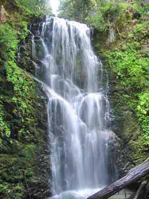
Spring view of Berry Creek Falls Big Basin Redwoods State Park
Type: Fireroads
Distance: Various, up to 9-mi loop or 12-mi out-and-back
Location: Boulder Creek, CA [Map it]Gentle fireroads through towering redwoods. Would be an awesome place to mountain bike, but all singletrack trails have been closed to bikes. From the park headquarters, the best ride is probably to take Gazos Creek Road to Sandy Point and loop back on Johansen Road and the Middle Ridge Road (rough approx. 9-mi loop). Another ride possibility is a 6-mi each way out-and-back fireroad ride from Waddell Beach to Berry Creek Falls (note: you aren't allowed to ride all the way to the falls and should bring a bike lock). Overall, Big Basin is much better hiking...
Directions from SF (~1hr45min):
Trail Map: bigbasin.org
Photos: Waddell Creek/Berry Falls Mtn Bike Ride
More info: California State Parks site
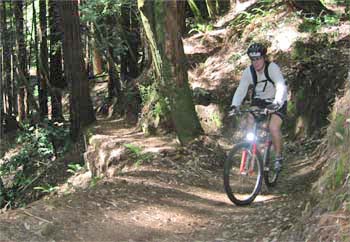
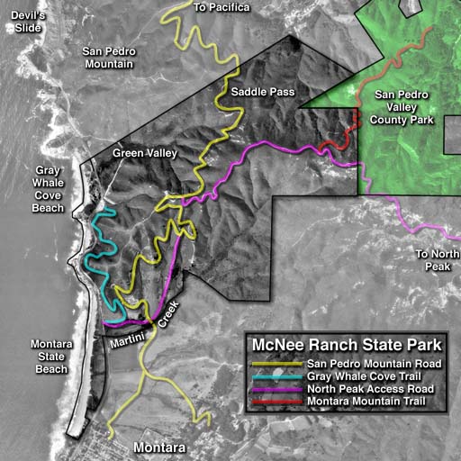
Montara Mtn. ("The Wall" ride)
Type: Fireroads
Distance: ~14 mi out-and-back
Location: Near Montara, CA [Map it]One of the closest places to ride from SF, Montara Mountain provides a huge workout ride looming over the Pacific coast. Starting on an abandoned, overgrown road of splintered pavement, the trail climbs steadily until hitting a purely dirt jeep trail that winds its way to the summit. All that really sticks in your mind about this climb, however, is a section known simply as "The Wall" (500 ft vert in half a mile); you'll see what I mean. Although I have hit the wall on The Wall, it has never conquered me. Perhaps I will never go back - it's good to retire when you're undefeated. Keep your eyes out fo short singletracks branching off of the main fireroad along the way - see links below for more details.
A short (yet in places pretty overgrown) section of singletrack, the Gray Whale Cove Trail, starts at the Gray Whale Cove Beach parking lot. You can either start in this parking lot or park further south on Rt. 1 at the Montara State Beach parking lot.
Also of note is a "gnarly" singletrack that branches off of the main fireroad at the top of The Wall and loops back in below. This is an extremely technical stretch -- only run this if you're pretty sick and have full body armor (and maybe disc brakes). See mtbreview.com for info on highly technical singletracks such as The Crack and Boyscout.
Directions from SF: (~30 min)
Trail Map: plants.montara.com
Photos: Panoramas(virtualparks.org)
More info: mtbwest.com (map, elevation profile, and route summary)
El Corte de Madera OSP (from Skegg's Point)
Singletrack through dense redwoods
Type: Network of singletrack and fireroads
Distance: Various loops, ~9-14 mi
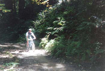
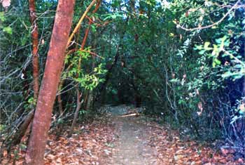
Location: Near Woodside, CA [Map it]The first time I rode from Skeggs I stayed on fireroads most of the way, it was 90 degrees, and I ran out of water. Still, it was #4 on my Top 5: I recognized that the vastness of the trail network warranted continued exploration. When I returned I hit some of the classic singletrack runs - Resolution Trail, North Leaf Trail, Methusulah Trail, Giant Salamander Trail - and was amazed at how little of the area I had seen on my first visit. Guys from my group were all over the place - supermanning into holes, timbering into rocks with shoes still clipped. One friend of mine careened over the side of Resolution Trail and only stopped sliding when his bike hit a tree 20 yards below. Only a few cuts and scratches - he'll be fine... but his bike? Personally, I escaped with only a hissssssssss at the bottom of an adrenaline-laced bomb down Methuselah.
Brief descriptions of some of the singletracks found in Skeggs: